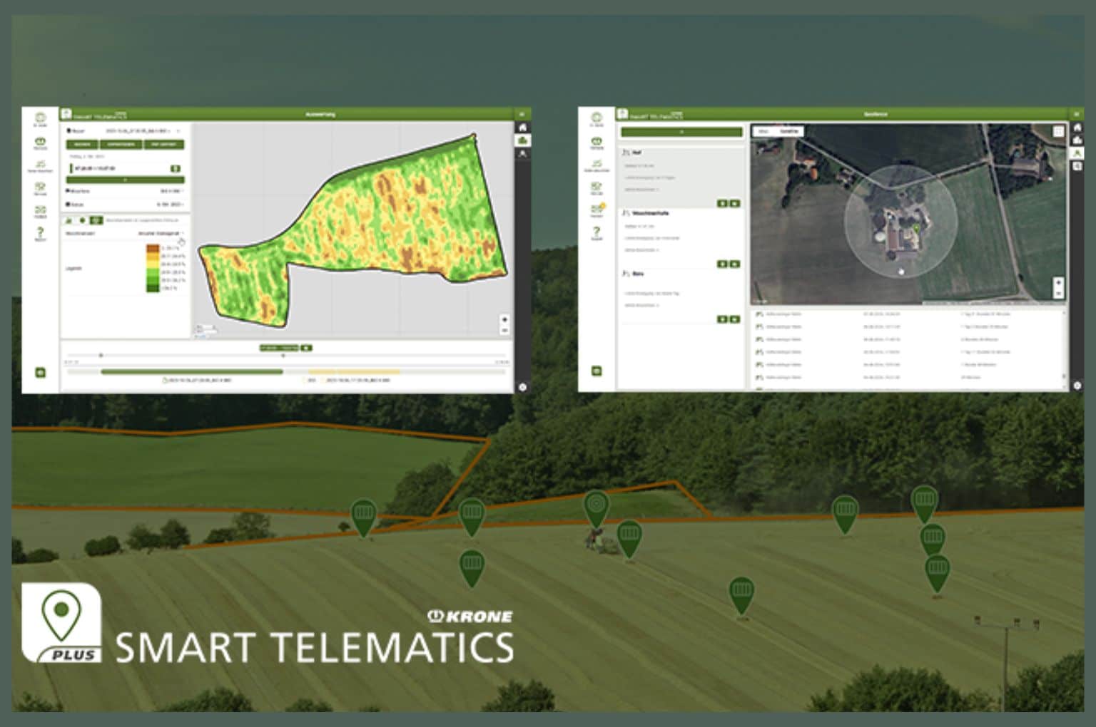
The new KRONE Smart Telematics Plus offers a host of additional innovative functions to make daily work easier on the field and in the office. It provides more convenient analysis and usage of machine data.
Data management based on telemetry modules, has been a familiar part of KRONE for a many years. Using the KRONE SmartConnect and SmartConnect Solar telemetry units, machine data is automatically transferred in real time to the Smart Telematics application in mykrone.green central support. In addition, this data can also be transmitted to a variety of farm management systems via the agrirouter 2.0. Now KRONE Smart Telematics has received numerous enhancements with the new Plus version for even more convenient and efficient use of the available machine data.
In the Plus version, machine and yield data can be exported not only as pdf files, but also as Excel and ISOXML files. This enables fast and easy evaluation of larger amounts of data, for example covering several days or an entire harvest season.
Yield and content maps of the BiG X forage harvester with KRONE NIR Control can also be displayed in dual format and exported as Shape files. This data can be further processed in farm management systems to provide a precise analysis of crop quality. It also offers information for selective management measures so that operating resources can be used more efficiently and yields can be optimised through section-specific sowing, fertilising and crop protection.
All machines at a glance with geofencing
With the Geofence function the user can mark an area on a map where machine movements will be documented. This will show which machines are located in the geofence that has been set up, for example the operating site. The times when machines enter or leave this area are also recorded. Based on the arrival and departure times, the function automatically calculates how long the machines were in the area, which is especially useful when invoicing for machine rental. The user can also set up e-mail notifications and be informed as soon as a machine enters or leaves the geofence.
The Smart Telematics Plus licence includes access to the SmartBale app. A bale map shows all round and square bales of the KRONE balers. In this way the driver of a collecting vehicle can find the bales quickly without a long search, especially if they are difficult to spot on winding fields or in the dark. In addition to the position of the bales, the SmartBale app also provides other information depending on how the baler is equipped, including details on moisture, weight and dimensions. Thanks to an adjustable threshold value, moist bales are also marked in colour on the map so they can be reliably recognised and stored separately. Square bales that have the KRONE BaleTag can be exactly identified by QR code using the SmartBale app and can also be tracked after they have been collected on the field.
Central data management with CCI.Maps
Smart Telematics Plus gives the user access to the new manufacturer-independent master data management with CCI.Maps. Master data such as customer information, field contours and field names can also be managed centrally in a single database. The advantage: Automatic synchronisation between CCI.Maps, CCI terminals and connected systems ensures uniform data. Field contours with the corresponding information can also be viewed in Smart Telematics Plus.
The functions of Smart Telematics are still available at no cost, while the Plus version with additional advantages can be purchased in the E-Solutions Shop through mykrone.green central support. A 4-week test license is available to try out the new functions.


